JMap Cloud is a cloud-based geospatial platform designed for developers and system integrators who need to add advanced mapping capabilities to their applications. It offers cloud services and robust APIs that simplify the integration, visualization, and querying of heterogeneous geospatial data from various formats (vector, raster, web services) and sources (OGC services, local files, etc.) as well as the various cartographic applications that can connect to the platform.
The platform is built around containerized, interoperable, and scalable microservices, complies with geospatial industry standards (OGC, GeoJSON, WMS/WFS, etc.), making it easily interoperable with existing GIS systems or business applications.
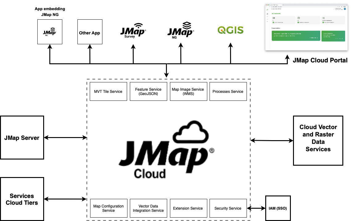
The following figure illustrates the architecture of JMap Cloud, including its main services (authentication, data management, map rendering, etc.), possible interconnections with the organization’s information systems (databases, internal web services) via JMap Server, as well as front-end interfaces used by end-users via mapping applications.

JMap Cloud Portal serves as the web management interface for the platform. It provides administrators and authorized users with advanced visual tools to:
Import geospatial and non-spatial datasets;
Create, configure, and publish mapping projects;
Manage users, roles, and access rights;
Monitor the technical ecosystem connected to JMap Cloud.
In summary, JMap Cloud Portal enables centralized governance of an organization’s geospatial data and mapping services in a secure, flexible, and scalable cloud environment.


